
Reservoir Characterization: Faster analysis, clearer QC in RokDoc 2026.2
The latest advancements in RokDoc's classification functions and Bayesian upgrades are set to redefine the way geoscientists approach facies classification, lithology analysis, and reservoir characterization.
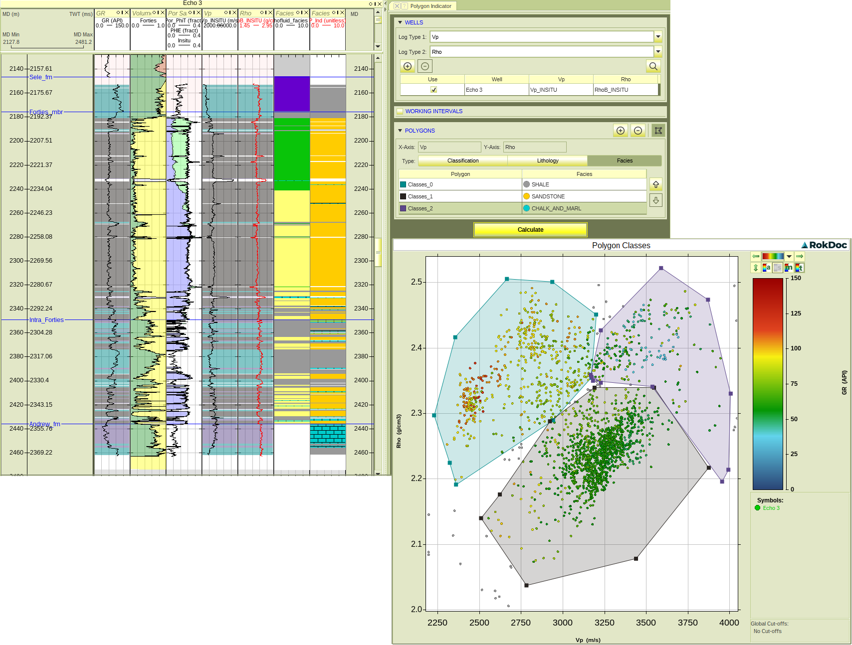
Geoscientists often face challenges when attempting to incorporate visual observations into their classification workflows. However, the latest enhancements in RokDoc have eliminated these hurdles. Users can now directly employ polygons for facies and lithology classification, simplifying the process and making it more accessible and user-friendly. This advancement not only saves valuable time but also enhances the precision of classification. Polygons may used to directly classify facies and lithologies at the well and in RokDoc 2D and 3D.
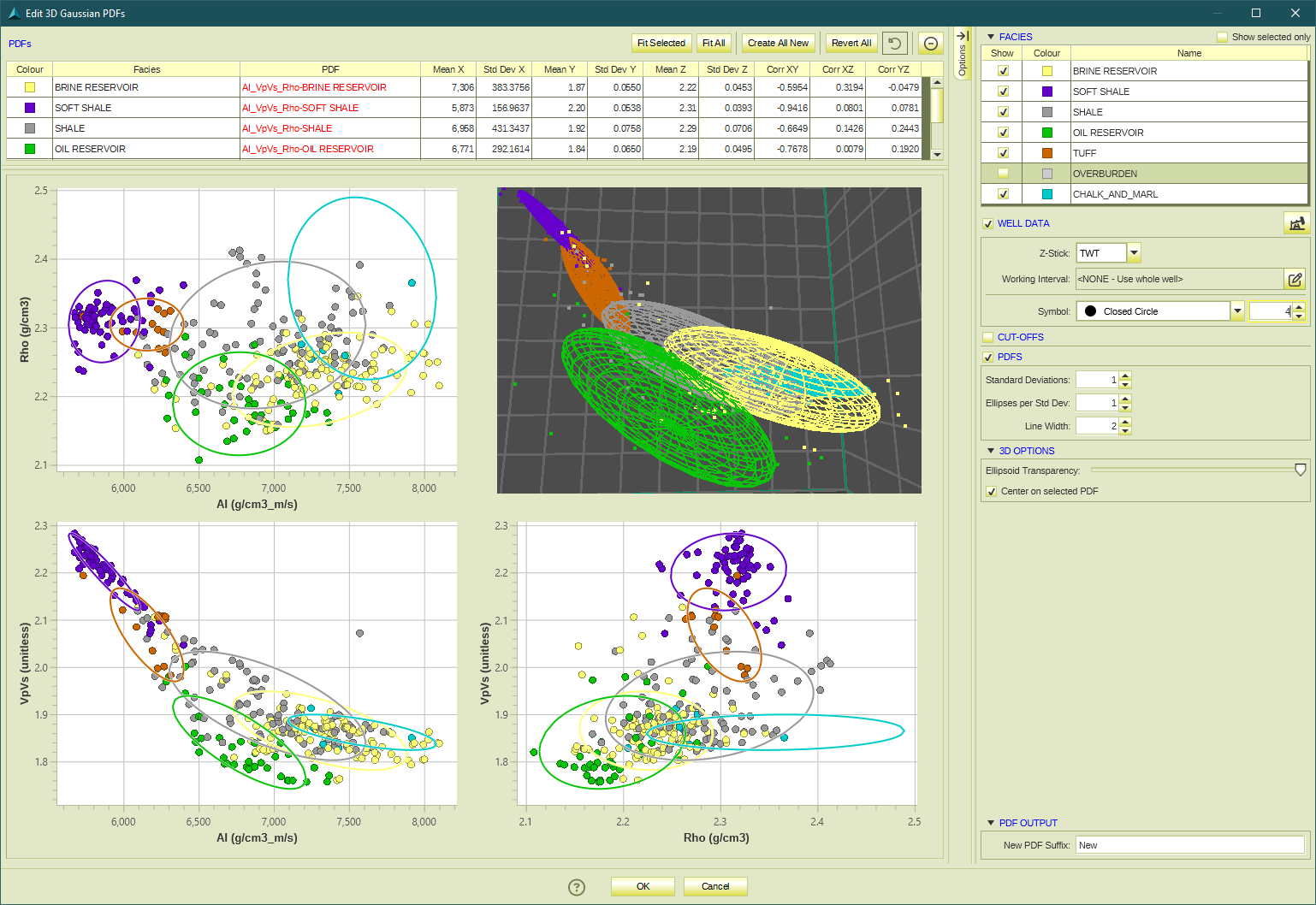
RokDoc's multi-release Bayesian Classification upgrade is a game-changing development. It now brings support for 1D, 2D, 3D, and depth-varying Probability Density Functions (PDFs). What does this mean for geoscientists? It means greater flexibility and accuracy in classification.
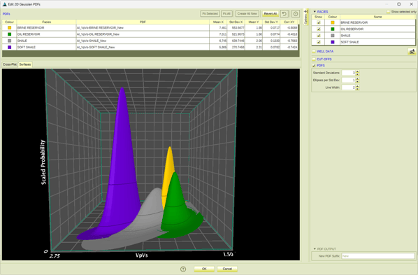
In the new Surfaces tab, we can see the 2D PDFs plotted as surfaces, with probability plotted as height. Lines for each standard deviation are shown on the surfaces.
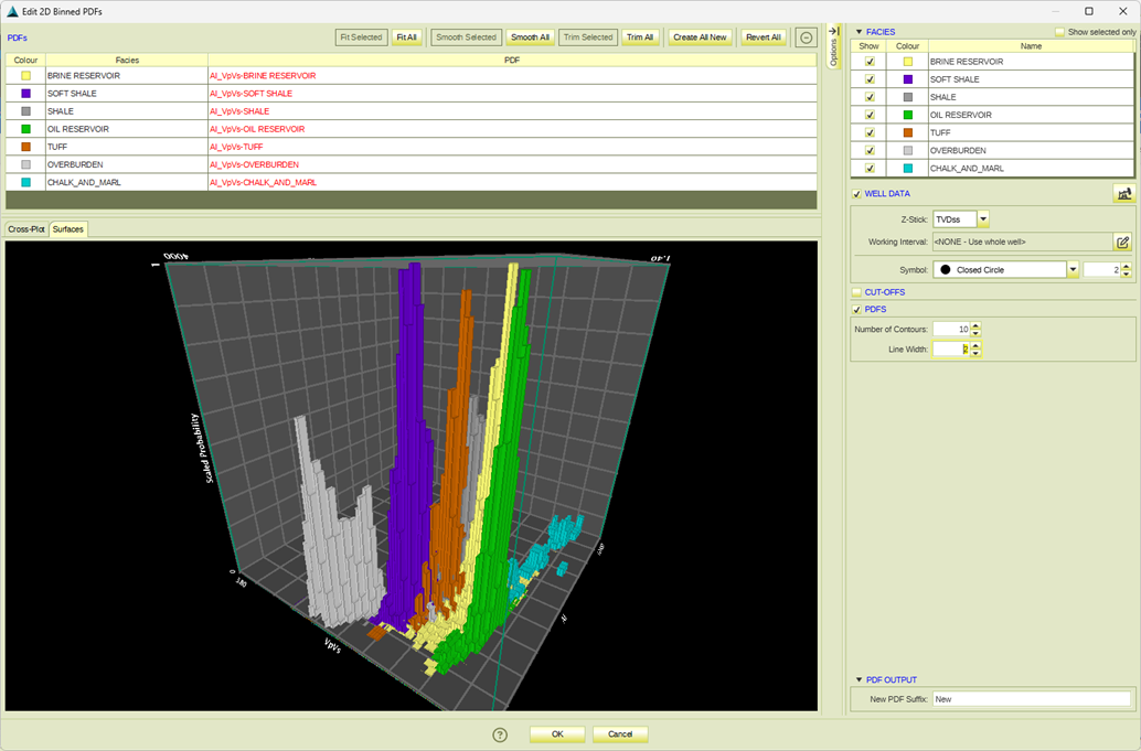
When showing Binned PDFs, a tower plot is shown to depict the probability values in each bin:
Depth trends may now be used for just 1 parameter (e.g. AI only) and up to 3 parameters. It can be used for different combinations of DTA-derivable parameters such as depth-varying AI, VP / VS, and Density.
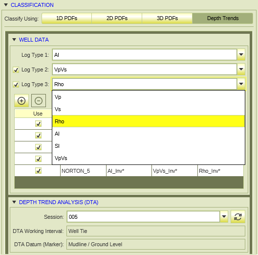
This opens the door to new workflows such as post-stack inversion classification and easier utilization of pre-existing property volume data for characterization with RokDoc.
In summary, the latest enhancements in RokDoc's classification functions and Bayesian upgrades are a testament to the commitment to excellence in reservoir characterization and geological analysis. Direct polygon usage for facies and lithology classification, support for 1D to 3D depth-varying PDFs, and the ability to utilize depth trends and advanced parameters open up new horizons in workflows and data interpretation. The result is a more stable, accurate, and user-friendly experience that empowers geoscientists to perform efficient workflows to make informed decisions and unlock the full potential of their subsurface data.

Alan Mur has a PhD in Geology with specialization in Geophysics from the University of Pittsburgh and has over a decade of work experience in geology, rock physics, and geophysics. As Product Manager for Quantitative Interpretation (QI) Applications at Ikon Science, he manages all applications related to QI geophysics at Ikon and directs the software development team to evolve Ikon’s software offerings with consideration for the needs of the industry.


.jpg?width=500&height=500&name=output%20(1).jpg)